
 by
by 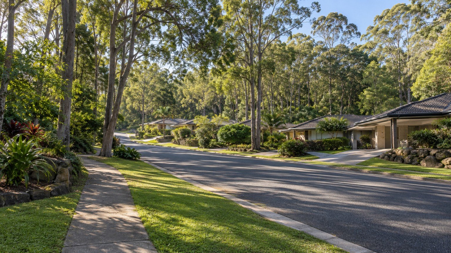
Daisy Hill is an established, heavily-treed suburb north of the South East Freeway and Pacific Motorway, within the Logan City Council local government area’s Division 3. Its residential subdivisions are built into and around the hills of Daisy Hill State Forest, giving the suburb a genuinely bushland character that sets it apart from Logan’s newer greenfield estates. The suburb takes its name from native daisies recorded on an 1905 marriage certificate, with European settlement dating from 1868, a long history that shows in the maturity of its street trees and established gardens compared with much of the surrounding Logan corridor.
Housing and Population
A community-profile estimate puts Daisy Hill’s population at around 6,925 residents across 2,584 dwellings, with an average household size of 2.76. This figure is sourced from a demographic-profile aggregator rather than a directly-pulled Australian Bureau of Statistics page, so it should be treated as an estimate rather than a precise Census figure. Buyers who need an exact number should confirm it directly against abs.gov.au. The suburb’s hillside topography also means block sizes and orientation can vary considerably from street to street, worth inspecting in person rather than assuming a uniform lot profile.
Transport
Daisy Hill has no dedicated railway station of its own and is not directly served by a Beenleigh-line stop. Bus services connect the suburb to Brisbane and the wider Logan corridor via the nearby Springwood busway interchange. This is a genuine transport trade-off worth stating plainly rather than implying rail access where none exists, and buyers who rely on public transport for work should test the actual bus-to-busway journey time before committing to a specific address.
Schools
Daisy Hill State School, a public primary school with a stated capacity of 378 students, serves the suburb. Secondary schooling is likely to be via Springwood State High School given the local geography, but this has not been verified as an official catchment fact for this guide. Being within a general catchment area does not guarantee enrolment, so verify the exact catchment for a specific address using the Queensland Government’s EdMap tool before assuming a place at either school.
Health
There is no hospital in Daisy Hill. Logan Hospital, at Meadowbrook, is the nearest major public facility, consistent with the pattern seen elsewhere along the Logan corridor.
Shopping
Daisy Hill Shopping Village serves the suburb locally, and residents also draw on the larger retail cluster nearby in Springwood, which is a short drive away and offers a considerably wider range of shops and services.
Parks and Open Space: Daisy Hill’s Standout Asset
Daisy Hill Conservation Park and Koala Centre is the suburb’s most recognisable feature, a free Queensland Government koala education facility open daily from 10am to 4pm since 1995, with twice-daily keeper talks. It links with Venman Bushland National Park and surrounding council land to form more than 1,500 hectares of protected bushland, one of the most intact natural koala habitats between Brisbane and the Gold Coast, with shared trails for cycling, horse riding and bushwalking. Daisy Hill State Forest was gazetted in 1917 and became Queensland’s first State Forest Park in 1986. For buyers who value genuine bushland access on their doorstep, this combination of scale, name recognition and free public amenity is difficult to match elsewhere in the wider Logan corridor.
Planning and Development
A Daisy Hill Cupania Street Precinct rezoning proposal, reportedly raising residential density from 20 to 40 dwellings per hectare, has been considered by Logan City Council. Its current status has not been verified for this guide, and the most recent confirmable coverage available dates from around 2020. Anyone considering a property in or near this precinct should check Logan City Council’s PD Online or Logan Plan pages directly for the current status before treating this rezoning as either current or resolved.
Flood Risk and Hazard Research
Logan City Council maintains its own flood-mapping tools, separate from Brisbane City Council’s FloodWise branding, so confirm the exact current tool name and URL directly rather than assuming it mirrors that approach. Daisy Hill’s hillside, forest-adjacent positioning also makes a bushfire-overlay check a genuinely relevant step for properties adjoining the Conservation Park or State Forest. This is presented as a reason to check, not a stated risk, and as always, check the official council tool for the specific address rather than for the suburb as a whole.
Family Considerations
The Koala Centre and more than 1,500 hectares of connected bushland are a genuine, high-recognition family and lifestyle asset that distinguishes Daisy Hill from Logan’s greenfield growth-corridor suburbs. Families considering the area should confirm school catchment via EdMap rather than assuming Springwood State High School will be available, and should also weigh the bus-only commute against their household’s daily travel needs.
Buyer Considerations
Confirm Logan Planning Scheme zoning for the specific lot, including the current status of the Cupania Street Precinct rezoning if the address falls within it. Check the Logan flood-mapping tool for the address, and for forest-adjacent properties, check any applicable bushfire overlay. Verify school catchment via EdMap, and factor in the bus-only, no direct rail, commute profile before relying on public transport for daily travel.
Nearby Comparisons
Daisy Hill shares its busway-not-rail transport story with nearby Park Ridge, and is also worth comparing with Yarrabilba and Beenleigh, both of which offer a useful contrast between Daisy Hill’s established, bushland-adjacent character and Logan’s newer greenfield growth suburbs. Reading all three guides together gives a clearer sense of how Daisy Hill’s bushland setting trades off against the newer infrastructure on offer elsewhere in the corridor.
Practical Research Checklist
- Verify school catchment for Daisy Hill State School and likely Springwood State High School via EdMap.
- Confirm the current Logan flood-mapping tool and check it for the specific address.
- Check the current status of any Cupania Street Precinct rezoning directly with Logan City Council.
- Factor in the bus-only commute access before relying on public transport for daily travel.
This article is general property research information only, and is not financial, legal or valuation advice. Suburb boundaries, school catchments, flood mapping and planning provisions can change, so always verify current details with Logan City Council, the relevant Queensland Government agency or a licensed professional before making a purchasing decision. For general guidance before choosing an area in Logan, see Moving to Logan: What to Research Before Choosing an Area.



Join The Discussion