
 by
by 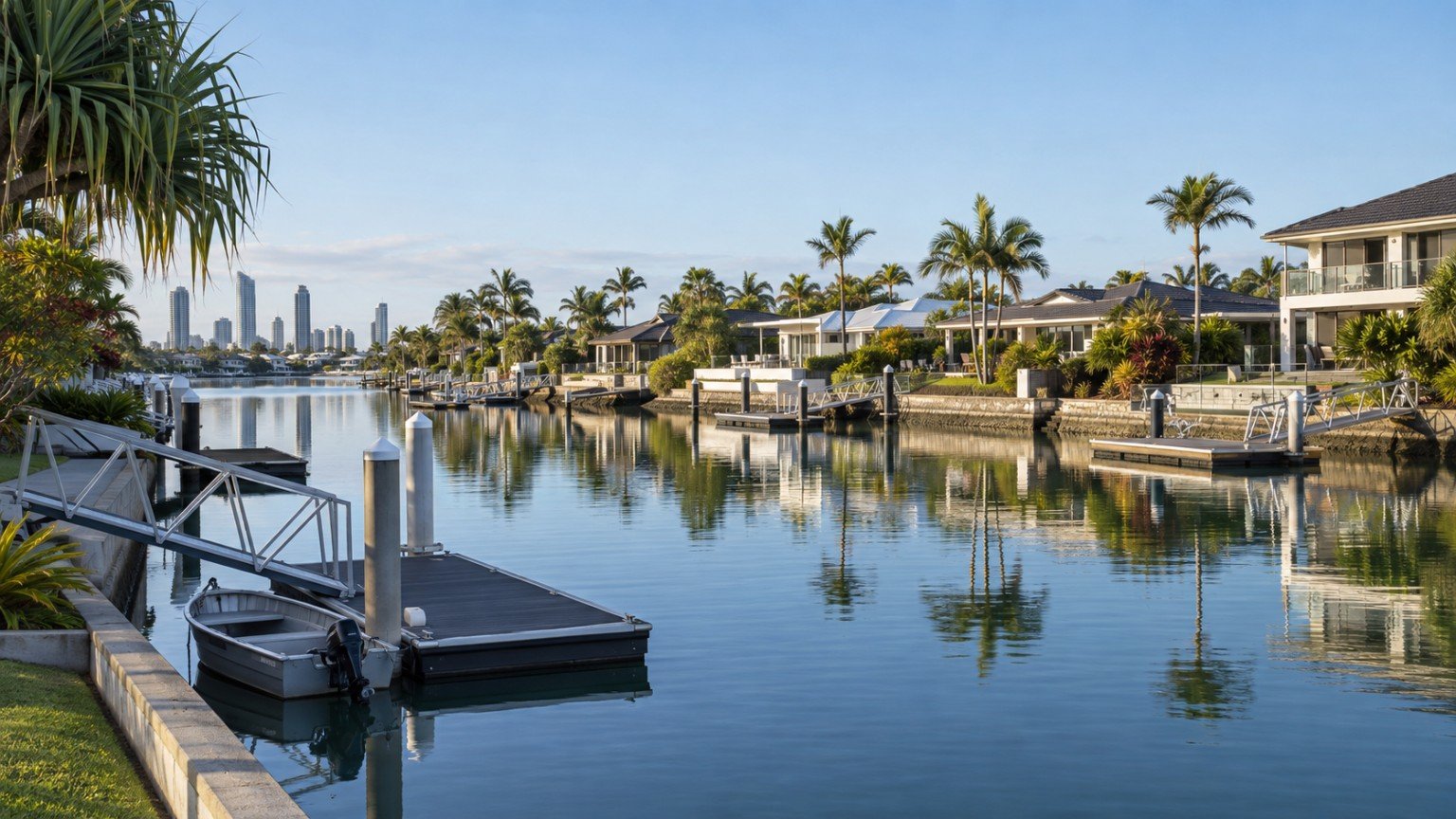
The Gold Coast has a long history of building around water, from artificial canal networks to lake estates, and for buyers looking at waterfront or near-waterfront property, flood and waterway research deserves a closer look than a standard suburb search. Importantly, the Gold Coast is not covered by Brisbane City Council’s FloodWise system. If you have used Narevella’s guide to reading a Brisbane FloodWise property report for research elsewhere in South East Queensland, that tool and its terminology simply do not apply here. The City of Gold Coast maintains its own, separate flood-mapping system, and it is worth understanding how it works before you get deep into canal or lake estate research specifically.
The City of Gold Coast’s Own Flood Mapping Tools
City of Gold Coast provides three official flood-mapping layers, all accessible through goldcoast.qld.gov.au/Planning-building/Flood-maps:
- Flood Risk Awareness Map, a city-wide categorised view of flood risk from low through to very high.
- Flood Insurance Map, which shows property exposure across several flood-probability scenarios and is genuinely useful groundwork before an insurance conversation.
- Flood Depth Map, giving an estimated depth for a 1% annual-chance flood event at a given location.
For more detailed, address-specific due diligence, a paid Flood level search report is also available through council. For a canal-front or lake-front property, this paid report is often worth the modest cost given how much value sits on the water.
Why Canal and Lake Estate Properties Need a Closer Look
A block backing directly onto a canal or lake is exposed to different flood behaviour to a standard inland lot. Tidal movement, waterway flow during heavy rain, and the condition of seawalls all matter in a way they simply do not for a property several streets back from the water. Buyers considering a canal-front or lake-front lot should specifically check waterway and tidal flood behaviour for that address, seawall condition, and whether any canal-specific overlay provisions apply under the City Plan, rather than assuming the general suburb reputation tells the full story.
Mermaid Waters: Built Around Its Waterways
Mermaid Waters is one of the clearest examples of just how much a Gold Coast suburb can be shaped by artificial waterways. The suburb is built almost entirely around a network of canals and lakes, centred on the roughly 17-hectare Lake Hugh Muntz. It is worth remembering that this land was originally flat grazing country interspersed with swamps draining toward a nearby creek, long before the canal estate took shape. That history is part of why waterway behaviour, rather than just rainfall, is a genuine factor for property here. Buyers interested in the area more broadly can also see the Mermaid Waters suburb guide for wider context on the area.
Isle of Capri, Surfers Paradise: Canal Character in a High-Rise Suburb
It is easy to think of Surfers Paradise purely in terms of its high-rise skyline, but the suburb also contains Isle of Capri, a canal-estate precinct with a very different, lower-density waterfront character despite the name suggesting an entirely different kind of place. It is a useful reminder that canal-estate research questions can apply even within a suburb best known for something else entirely. See the Surfers Paradise suburb guide for more on the suburb as a whole.
Maintenance Obligations on Canal-Front Titles
A question that catches out some canal-front buyers is who is actually responsible for maintaining the waterway infrastructure attached to a property, things like seawalls and periodic dredging. This is not something to assume. Depending on the property and the estate, responsibility can sit with the individual owner, a body corporate, or the council. Always confirm this directly with the relevant body corporate or council for the specific address rather than relying on what a neighbouring property or a general estate reputation suggests.
A Practical Approach Before You Buy
For any canal-front, lake-front, or general Gold Coast property research, start with the three free City of Gold Coast mapping layers for a general picture, then consider the paid Flood level search report for a genuinely address-specific answer if you are proceeding toward an offer. For waterfront titles specifically, request the community management statement or relevant title documents and confirm maintenance obligations in writing rather than by assumption. None of this replaces a suburb-wide verdict, because flood and waterway risk genuinely varies address by address, even within a single canal estate.
This article is general research information only, not financial or legal advice. Always confirm flood and waterway details for a specific address using official City of Gold Coast tools, and seek independent professional advice before making a property decision.


Join The Discussion