
 by
by 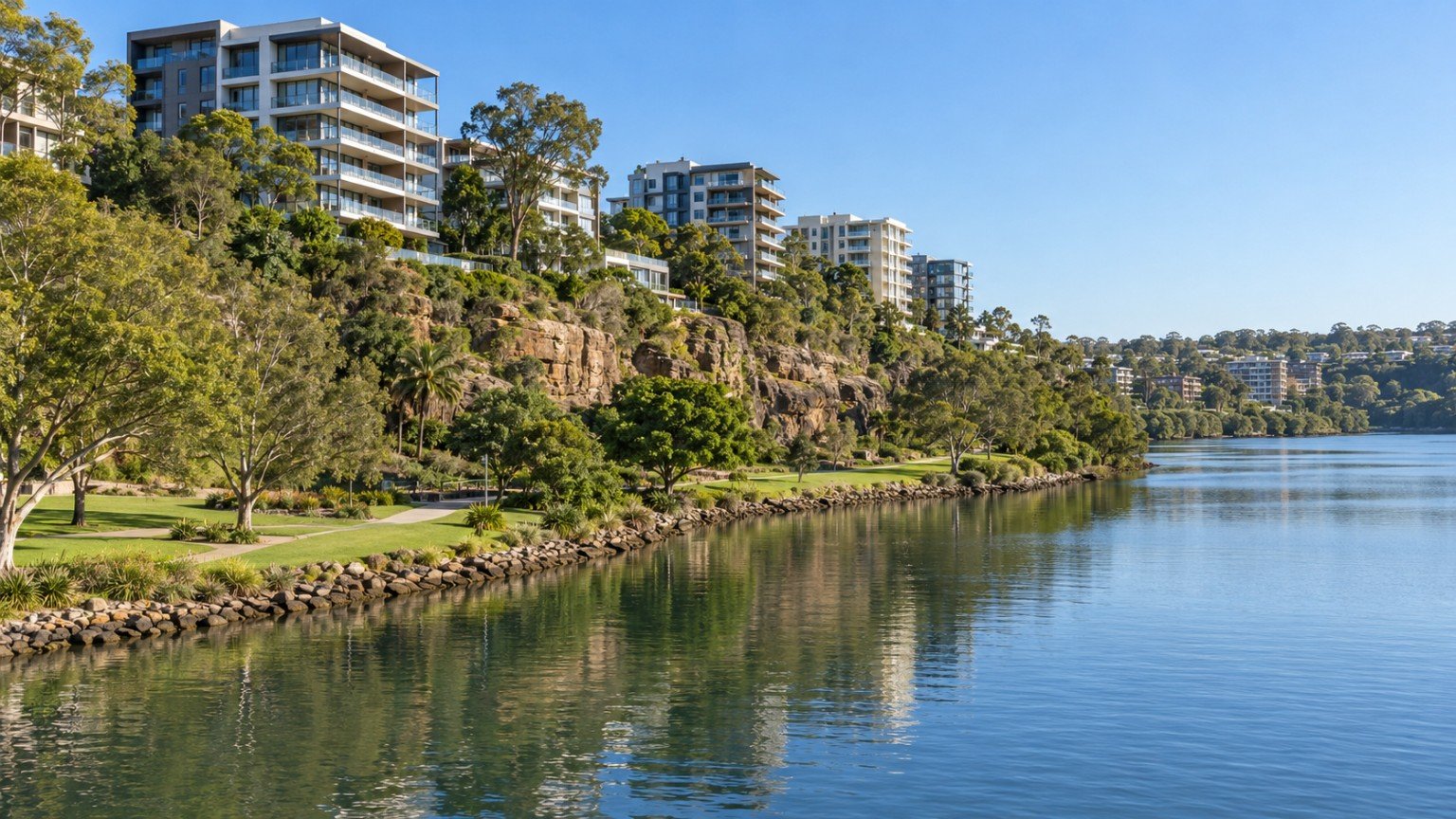
Kangaroo Point is a riverside peninsula wrapped on three sides by the Brisbane River, directly across from the CBD, within the Brisbane City Council local government area’s Gabba Ward. The suburb is defined by the sandstone Kangaroo Point Cliffs, the heritage-listed Story Bridge, and a mix of high-rise river-view apartment towers on the plateau alongside older character housing closer to the bridge. That contrast, gleaming towers on one side of the peninsula, quieter character streets on the other, is part of what makes Kangaroo Point worth exploring in person rather than judging from a single listing photo.
Housing and Population
2021 Census data (SAL31481) records 9,689 residents, an average household size of 1.8, and 6,070 private dwellings, an apartment-dominant profile. Character Residential zoning specifically protects the lower, near-bridge portion of the peninsula, while Medium and High Density Residential zoning applies on the plateau, so the zoning picture can vary considerably within a short walk depending on exactly where a property sits. This zoning split is one of the more distinctive features of Kangaroo Point compared with other river-facing Brisbane suburbs, and it directly shapes what a future owner can and cannot do with a given property.
Transport
The Kangaroo Point Green Bridge, a dedicated pedestrian and cyclist bridge, opened on 15 December 2024, connecting Kangaroo Point directly to the CBD near Alice Street and Edward Street via the Thornton Street ferry wharf area. At 470 metres and cable-stayed, it is Queensland’s tallest bridge, and an overwater restaurant and café were added in early 2025. CityCat ferry terminals at Holman Street and Thornton Street also serve the peninsula, and the Story Bridge carries road traffic across its northern tip. There is no rail station in the suburb. For how the wider Cross River Rail project changes access on this side of the river, see Narevella’s Cross River Rail completion guide.
Schools
No dedicated state school sits within Kangaroo Point itself. East Brisbane State School commonly serves the area in general discussion, but this has not been verified as an official catchment fact for this guide. Being near a school, or hearing it described as the local option, does not guarantee enrolment. Always verify the exact catchment for a specific address using the Queensland Government’s EdMap tool before naming any school as the one your family will attend.
Health
There is no hospital in Kangaroo Point. Princess Alexandra Hospital, at Woolloongabba, and the Mater precinct, at South Brisbane, are both nearby, and both are reachable by a short trip across the peninsula or via the Green Bridge and CBD connections.
Shopping and Amenities
There is no major shopping centre within Kangaroo Point. Residents rely on the CBD, now directly bridge-connected via the Green Bridge, along with East Brisbane and Woolloongabba’s local strips, or South Bank and West End a little further along the river. The Green Bridge in particular has meaningfully shortened the practical distance to CBD shopping and dining for residents on the northern half of the peninsula.
Parks and Open Space
Kangaroo Point Cliffs Park, the sandstone cliff-top and cliff-face parkland popular for climbing, abseiling and river views, and Captain Burke Park, with its river frontage under the Story Bridge, are the peninsula’s standout open-space assets, and both are genuinely well used by residents rather than being tourist-only attractions.
Planning and Development
The Kangaroo Point Peninsula Neighbourhood Plan, part of City Plan 2014, was adopted and became effective from 28 February 2020. Its key features include strong building-height controls designed to preserve view corridors to and from the Story Bridge, the rezoning of land under the Story Bridge from high-density residential to community purposes, and the addition of two further properties to the City Plan Heritage Overlay. Buyers should check the current neighbourhood plan provisions and heritage overlay status directly for any specific lot, since height controls in particular can affect both an existing building’s outlook and any future redevelopment potential on the same site.
Flood Risk and Hazard Research
Flood research is genuinely important here given the peninsula’s three-sided river exposure. Documented history shows the 2011 flood, which peaked at 4.46 metres at the city gauge, inundated Lower River Terrace, James Warner Park, Captain Burke Park and the Holman Street ferry stop, while the 2022 flood, peaking at 3.85 metres, was driven by a different mix of creek and overland-flow factors. This history is general context only, never a suburb-wide or property-specific verdict. The official Brisbane City Council FloodWise Property Report, at fam.brisbane.qld.gov.au, is the correct address-specific tool, and low-lying sections of the peninsula in particular warrant a careful individual check given the 2011 history.
Family Considerations
The low household-size profile of 1.8 suggests Kangaroo Point suits investor and unit buyers, downsizers and lifestyle buyers considerably more than family upgraders. Where family buyers do consider the area, verifying the school catchment via EdMap is the essential first step, rather than assuming any nearby school will be available.
Buyer Considerations
Confirm City Plan zoning, Character Residential near the bridge versus Medium or High Density on the plateau, and Heritage Overlay status via the neighbourhood plan for the specific lot. Run a FloodWise Property Report for the exact address, particularly for lower-lying sections. Check body corporate records given the apartment-dominant stock; Narevella’s body corporate checks guide outlines what to review. Verify school catchment via EdMap rather than assuming East Brisbane State School applies, and walk the specific street at different times of day to get a feel for cliff, river or bridge-related noise and activity.
Nearby Comparisons
Kangaroo Point is worth comparing with West End, South Bank, and the CBD itself, now directly bridge-connected, each offering a different balance of river amenity, housing stock and transport access. The Green Bridge has narrowed some of the practical differences with the CBD in particular, which is worth factoring into any side-by-side comparison.
Practical Research Checklist
- Run a FloodWise Property Report for the exact address, particularly for lower-lying sections.
- Check City Plan zoning and Heritage Overlay status via the Kangaroo Point Peninsula Neighbourhood Plan.
- Check body corporate records for any strata purchase.
- Verify school catchment via EdMap rather than assuming East Brisbane State School applies.
This article is general property research information only, and is not financial, legal or valuation advice. Suburb boundaries, planning provisions and flood mapping can change, so always verify current details with Brisbane City Council, the relevant Queensland Government agency or a licensed professional before making a purchasing decision.



Join The Discussion