
 by
by 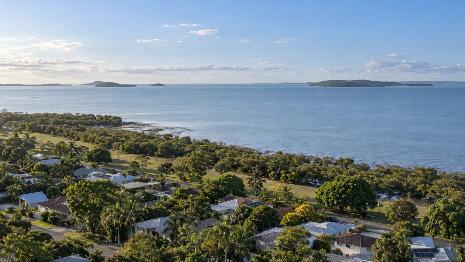
Redland City Council covers Brisbane’s bayside and island-adjacent local government area, stretching from established suburbs close to the bay through to the Southern Moreton Bay Islands. It has its own distinct research considerations compared with most other South East Queensland local government areas, largely because of its coastal geography.
A Genuinely Coastal Local Government Area
Because Redlands sits directly on Moreton Bay, storm-tide and flood research is a more consistently relevant step here than in most other SEQ local government areas. Redland City Council maintains its own flood-mapping tools, which are distinct from Brisbane City Council’s FloodWise system, so if you are used to checking Brisbane addresses, do not assume the same portal applies. Always check the specific Redland City Council mapping for any address you are considering, coastal or not, since storm-tide overlays can extend further inland than expected in some areas.
Bayside Suburbs and the Southern Moreton Bay Islands
Redlands includes well-known bayside suburbs such as Cleveland, along with the Southern Moreton Bay Islands, accessible by vehicle ferry from Redland Bay. Island living is a genuinely distinctive lifestyle feature of this local government area, offering a different pace and community feel to the mainland bayside suburbs, but it also comes with its own considerations around ferry timetables, service access and infrastructure that are worth researching specifically if you are considering an island property.
Transport and Commute Considerations
Redlands is served by the Cleveland rail line into Brisbane’s CBD, along with bus services and road access via various arterial routes. Commute times and options vary meaningfully depending on how close a suburb sits to the rail line or a major bus corridor, so check the specific transport options for an address rather than assuming Redlands-wide access.
Schools and Family Considerations
As with anywhere in Queensland, verify the school catchment for a specific address rather than relying on a suburb’s general reputation. See our guide to school catchments in Queensland for how to check using the Department of Education’s EdMap tool.
Where to Find Suburb-Level Detail
Narevella has a full suburb guide for Cleveland, Redland City’s principal centre, covering its planning, schooling and flood considerations in more depth than a Redlands-wide overview can provide. As more of our Redlands suburb guides are published, they will offer the same level of specific detail for other suburbs in the area.
Why You Should Compare Suburbs, Not Treat Redlands as One Market
Given the range from established bayside suburbs to the more distinct island communities, a general reputation for “Redlands” tells you very little about a specific street. Shortlist a small number of suburbs based on your own priorities and research each one individually.
Where Narevella Can Help
Our free Compare Suburbs tool can help you compare specific Redlands suburbs once you have a shortlist, and our Queensland Property Research Checklist offers a general due-diligence framework to apply to any address you are considering.
Disclaimer
This guide provides general research information only and does not recommend any particular suburb or area within Redlands. Flood mapping, transport and ferry information can change. Always verify current details for the specific address you are considering.
Join The Discussion